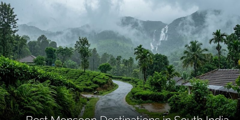
The arrival of the monsoon season completely transforms the geographical landscape of South India, turning the Western Ghats and the southern coastline into a high-density matrix of lush greenery, cascading river networks, and mist-covered peaks. Executing a successful travel routing or content curation strategy during this high-moisture window requires understanding local microclimates, terrain stability, and transit accessibility. This intelligence brief deconstructs the spatial mechanics, tactical utilities, and structural limitations of eleven premier monsoon destinations in the southern peninsula.
Technical Mechanics: Hydrodynamics, Altitude, & Vegetation Density
The unique appeal of South India’s monsoon terrain relies on the interplay between heavy precipitation and the distinct geographic traits of individual regions.
-
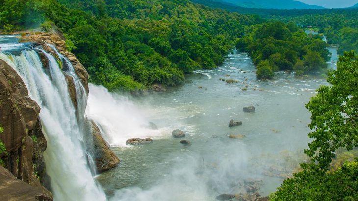
High-Altitude Hydrodynamics: Segmented plunge systems like Jog Falls (Shimoga) and the four-tiered torrent lines of Dudhsagar Falls (Goa border) achieve peak flow velocity during the rainy season. Managing visits to these areas requires close monitoring of dam gates (such as Linganamakki) and state-enforced safety closures.
-
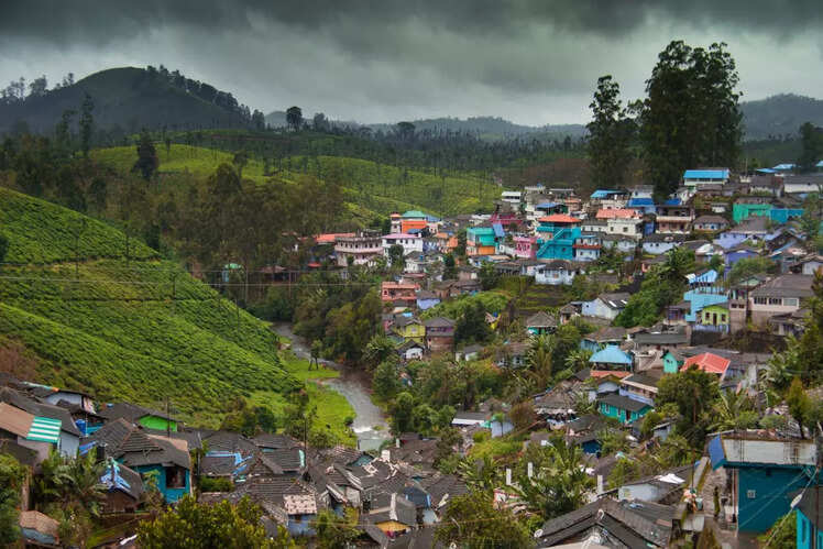
Plantation Microclimates: High-altitude valley networks in Coorg, Chikmagalur, Munnar, and Ooty feature dense concentrations of coffee, spice, and tea cultivation. The heavy rainfall strips away dust, maximizing color vibrancy and trapping aromatic essential oils in the ambient mist.
-
Low-Altitude Aquatic Tranquility: The coastal backwater networks of Alleppey operate on a different ecological scale, utilizing rainfall to cool maritime ecosystems and creating a highly textured, rhythmic audio-visual experience for traditional houseboat navigation.
Strategic Deployment Matrix
Structuring a successful monsoon routing requires aligning specific regional topographies with their optimal transit anchors, utility profiles, and baseline distances from major logistics hubs like Bangalore.
| Destination | Tactical Utility Profile | Geographic & Transit Anchor | Logistical Distance Baseline |
| Coorg (Karnataka) | High-gloss mist photography; coffee/spice estate immersion; adventure trekking. | Lap of Western Ghats; entry via Mysore/Mangalore rail heads. | ~250 km from Bangalore |
| Chikmagalur (Karnataka) | High-altitude peak scaling (Mullayanagiri); dense forest exploration; meadow visuals. | Mullayanagiri foothills; accessed via Kadur rail junction. | ~245 km from Bangalore |
| Wayanad (Kerala) | Low-density wildlife tracking; isolated eco-resort deployment; high-privacy curation. | Wayanad Wildlife Sanctuary; route via Kozhikode airport. | ~285 km from Bangalore |
| Sakleshpur (Karnataka) | Historical architectural integration (star-shaped Manjarabad Fort); heavy trail trekking. | Hemavathy River basin; direct national highway access. | ~221 km from Bangalore |
| Jog Falls (Karnataka) | Accessible, high-volume hydrodynamic visual observation (no trekking required). | Sagar Taluk, Sharavathi River; rail head at Shimoga. | ~400 km from Bangalore |
| Ooty (Tamil Nadu) | Premium high-altitude tea estate curation; colonial aesthetic integration; marketplace sourcing. | Nilgiri Hills crown; airport access via Coimbatore. | ~265 km from Bangalore |
| Alleppey (Kerala) | Aquatic insulation; specialized houseboat cruising; low-altitude relaxation. | Laccadive Sea coast; domestic rail network hub. | ~590 km from Bangalore |
| Munnar (Kerala) | High-value biodiversity tracking (endangered Nilgiri tahr); romantic valley styling. | Idukki District; major highway corridor from Kochi. | ~470 km from Bangalore |
| Kodaikanal (Tamil Nadu) | Mist-covered mountain styling; artificial lake center-point activities (boating, cycling). | Palani Hills zone; primary airport link via Madurai. | ~464 km from Bangalore |
| Dudhsagar (Goa) | High-intensity jungle trekking; multi-tiered torrent waterfall documentation. | Bhagawan Mahavir Sanctuary; internal jeep trails. | ~552 km from Bangalore |
| Goa (Coastal Zone) | Low-crowd coastal relaxation; mystic tropical beach photography. | Arabian Sea coastline; fully integrated international airport. | ~560 km from Bangalore |
Structural Vulnerabilities and Strategic Limitations
-
Flash Flooding & Seasonal Blockades: Peak monsoon inputs create significant structural vulnerabilities in low-lying or highly saturated regions. Coorg is prone to localized flooding during torrential downpours, while the intense jungle streams feeding Dudhsagar routinely force authorities to completely suspend entry to the falls for safety.
-
Transit Friction & Road Attrition: Navigating steep, narrow mountain roads in Chikmagalur and Sakleshpur during heavy downpours requires advanced driving competencies due to reduced visibility and landslide risk. Furthermore, strict administrative boundaries, such as Wayanad’s overnight forest checkpoint closures (9:00 PM to 6:00 AM), create rigid time constraints for arrivals.
-
Biological & Infrastructural Disruption: Trekking pristine waterfall trails during the rainy season brings unavoidable exposure to heavy leech activity, requiring specialized footwear and topical deterrents. Concurrently, remote locations in Wayanad suffer from significant network attrition and signal dropouts, making continuous digital connectivity impossible.
-
The Seasonal Shutdown Paradox: While a rainy environment enhances natural aesthetics, it introduces a complete pause in recreational beach infrastructure. In coastal Goa, all commercial water sports and beachfront shacks dismantle entirely for the duration of the monsoon, shifting the region’s utility strictly from active entertainment to passive relaxation.
Conclusion
The strategic verdict on South Indian monsoon travel is that success depends on matching the right geographic terrain with the appropriate travel style. For high-impact visual curation and crisp clean air, the elevated plantation zones of Karnataka and Tamil Nadu remain undefeated. For deep tranquility and off-grid relaxation, the backwaters and forest sanctuaries of Kerala provide excellent isolation. By anticipating logistical bottlenecks—such as early forest checkposts, landslide-prone roads, and park closures—you can design an efficient, refreshing, and visually stunning monsoon itinerary.
Also Read : Strategic Breakdown of the iPhone 18 Pro Leaks