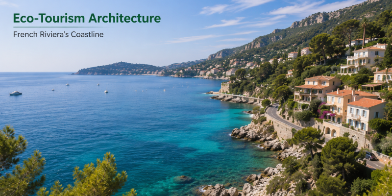
The French Riviera (Côte d’Azur) has historically been anchored by the high-net-worth ecosystems of Monaco, Cannes, and Saint-Tropez. However, modern eco-tourism and luxury travel strategies are increasingly pivoting away from heavily curated beach clubs toward secluded, topographically complex coastal assets. From the deep limestone fissures of the Calanques to the rare sandy expanses near the Italian border, the Riviera offers a highly diverse hydrological portfolio. This intelligence brief deconstructs the geographical mechanics, access friction, and strategic basecamp logistics required to optimize a deployment along the southern French coast.
Technical Mechanics: Topography & Hydrological Assets
The Riviera’s coastline is defined by aggressive shifts in topography, requiring travelers to understand the physical realities of their chosen destinations before deployment.
-
The Calanques Ecosystem: The Calanques National Park features some of the most extreme coastal topography in Europe. Assets like Calanque d’En-Vau are narrow, deep-water inlets carved into massive limestone cliffs. Because they are protected ecological zones, vehicular access is prohibited. Engagement requires a rigorous 1-to-2-hour hike over slick limestone trails, serving as a natural filtration mechanism that limits high-density tourist traffic and preserves the pristine aesthetic. Detailed trail guides are frequently cross-referenced by hikers on platforms like AllTrails.
-
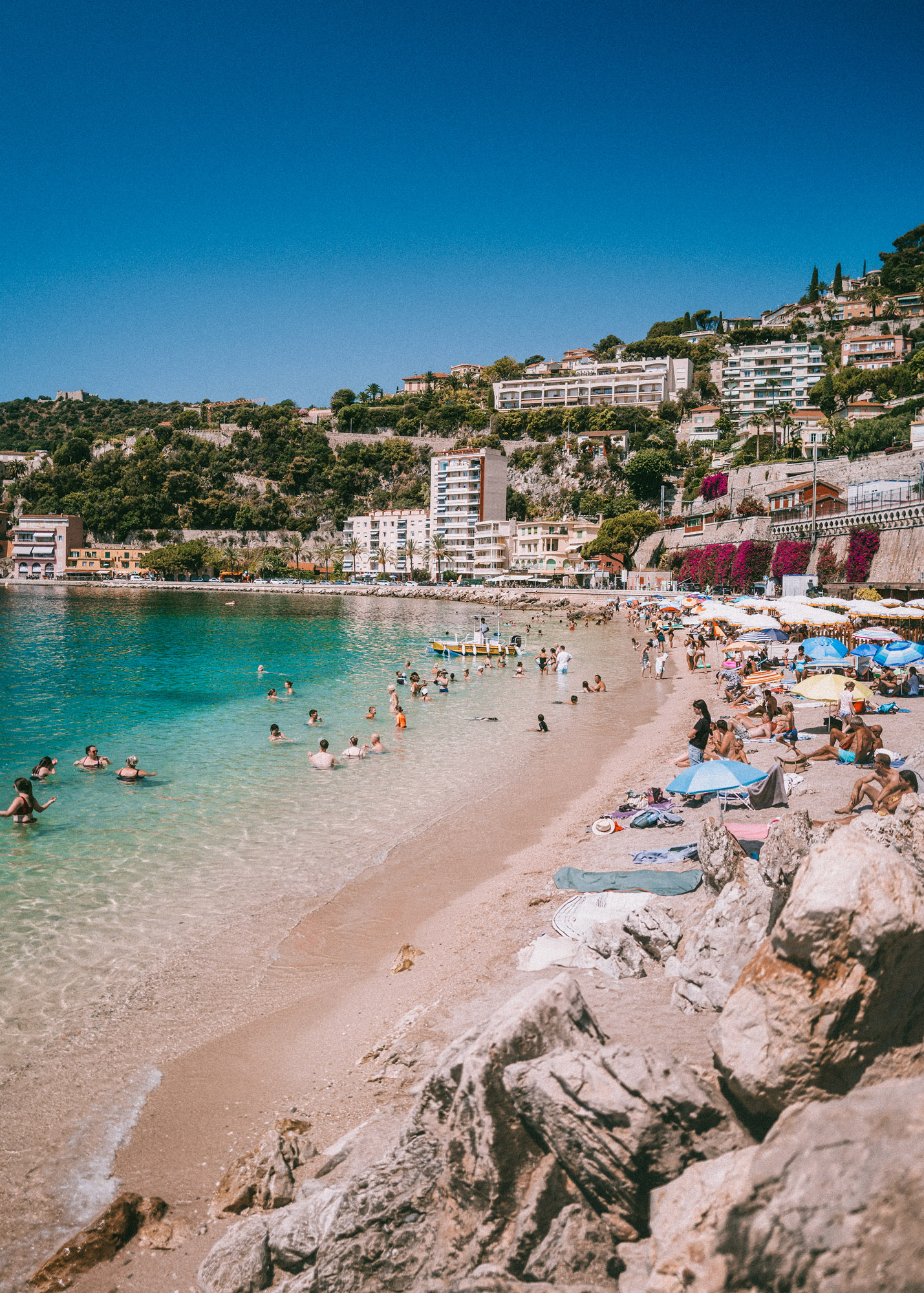
The Pebble vs. Sand Divide: A critical logistical factor for Riviera travel is shoreline composition. The vast majority of beaches around Nice, Villefranche-sur-Mer, and Cassis (such as Plage du Bestouan and Plage des Marinieres) are comprised of smooth stones or pebbles, requiring protective footwear for aquatic entry. Conversely, the far eastern edge near the Italian border (Menton’s Plage des Sablettes) offers rare, soft sand shores, making it a highly strategic target for family-oriented tourism.
-
Curated vs. Wild Coastlines: The Riviera operates on a spectrum of commercialization. Plage de Pampelonne in Saint-Tropez represents peak commercial architecture, driven by high-yield beach clubs (like Nikki Beach) and yacht moorings. In stark contrast, Plage du Mont Salva near Toulon offers zero commercial infrastructure, requiring visitors to navigate unpaved dirt lots and steep descents for a purely natural, uncurated swimming experience.
Strategic Deployment Matrix
Structuring a comprehensive Riviera itinerary requires matching the operational profile of each beach to the logistical capabilities and aesthetic preferences of the traveler.
| Coastal Asset | Tactical Geographic Zone | Strategic Utility & Engagement Model |
| Calanque d’En-Vau | Cassis / National Park | High-friction adventure hiking, remote ecological immersion, and deep-water swimming. |
| Plage de Pampelonne | Saint-Tropez | High-visibility commercial leisure, beach club hospitality, and yacht culture. |
| Plage Paloma & La Fosse | Saint-Jean-Cap-Ferrat | Elegant, low-key aquatic lounging optimized for private speedboat anchoring and paddleboarding. |
| Plage des Marinieres | Villefranche-sur-Mer | Accessible, family-friendly pebble beach with direct rail integration. |
| Plage des Sablettes | Menton (Italian Border) | Old-world sandy shores optimized for post-lunch leisure and soft entry swimming. |
Structural Vulnerabilities and Systemic Limitations
-
Severe Parking Friction: The primary logistical vulnerability across the entire Côte d’Azur is the extreme scarcity of vehicular parking. Mountainous terrain and historic village layouts restrict parking infrastructure. High-value targets like Saint-Jean-Cap-Ferrat and Cassis require travelers to arrive extremely early or rely entirely on public transit (trains) or pedestrian access to avoid significant delays.
-
Seasonal Crowding Dynamics: During the peak months of July and August, the accessibility of the Riviera works against it. Beaches with direct train access or easy parking (like Villefranche-sur-Mer) reach capacity quickly. Travelers must strategically deploy to high-friction targets (like the Calanques or Mont Salva) during peak hours, reserving easily accessible beaches for early morning or late afternoon engagements. Local tourism boards often issue updates on capacity limits, accessible via The French Riviera Tourism Board.
-
The Basecamp Strategy: Attempting to navigate the entire coastline from a single hotel is highly inefficient due to heavy coastal traffic. The optimal operational strategy involves establishing two separate basecamps: one in the east (e.g., Villefranche-sur-Mer) to execute strikes on Monaco, Cap Ferrat, and Menton, and one in the west (e.g., Cassis) to tackle the rugged Calanques and Toulon coastlines. This bifurcated approach minimizes transit times and maximizes active engagement hours.
Conclusion
The strategic verdict on the French Riviera is that its true value lies far beyond the immediate commercial centers of Cannes and Monaco. By understanding the severe topographical variations—from the demanding limestone hikes of En-Vau to the soft sands of Menton—travelers can engineer a highly customized itinerary. Success on the Côte d’Azur requires abandoning the expectation of easy, drive-up sandy beaches in favor of strategic rail use, rugged hikes, and a bifurcated basecamp model to conquer one of the most geographically diverse coastlines in the Mediterranean.
Also Read : Hospitality Architecture: Strategic Breakdown of Elite Maldives Family Resorts